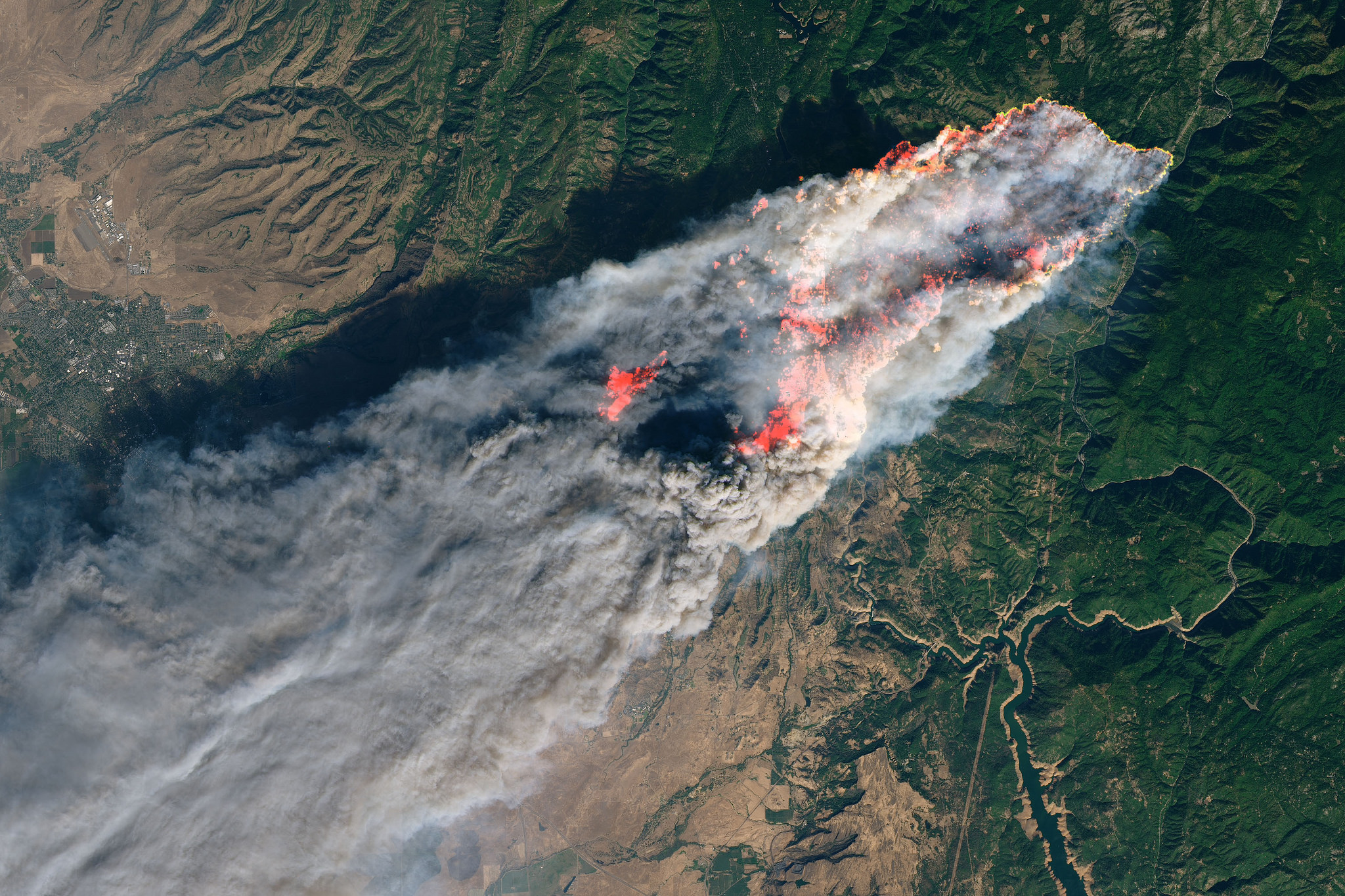
The extent of the damage from Camp Fire in Northern California is unimaginable. It's difficult to wrap your head around it without walking around each affected neighborhood. Thousands of buildings were destroyed, leaving many local residents without a home. The smoke from the fire affected populations hundreds of miles away in the San Francisco Bay Area and Central California. The total impact from the fire—economic, human, and environmental—is still not entirely known.
Given our recent work understanding building damage at scale after Hurricane Michael, the team at CrowdAI wanted to see how we could use our technology to help out. We wondered if our experience assessing building damage from satellite imagery could be leveraged to examine damage after a wildfire. We deployed our algorithms on open data from DigitalGlobe to understand the extent of damage in Butte County, and then correlated that information with county parcel data to understand the scale of property damage.
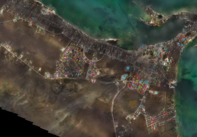
It should be noted that here, unlike some of our previous work, we detected structures rather than just buildings. Stand-alone structures like carports, utility sheds, and barns are included in our data.
Here's how we were able to determine the amount of damage after the fire:
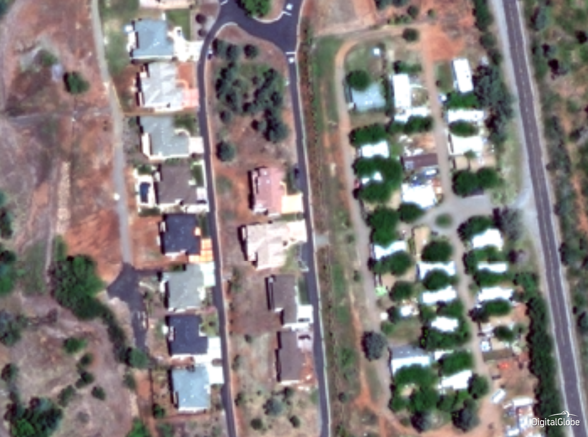
Using our custom deep learning models, we automatically identified structures across the entire impacted region from pre-fire imagery to create a point of reference.
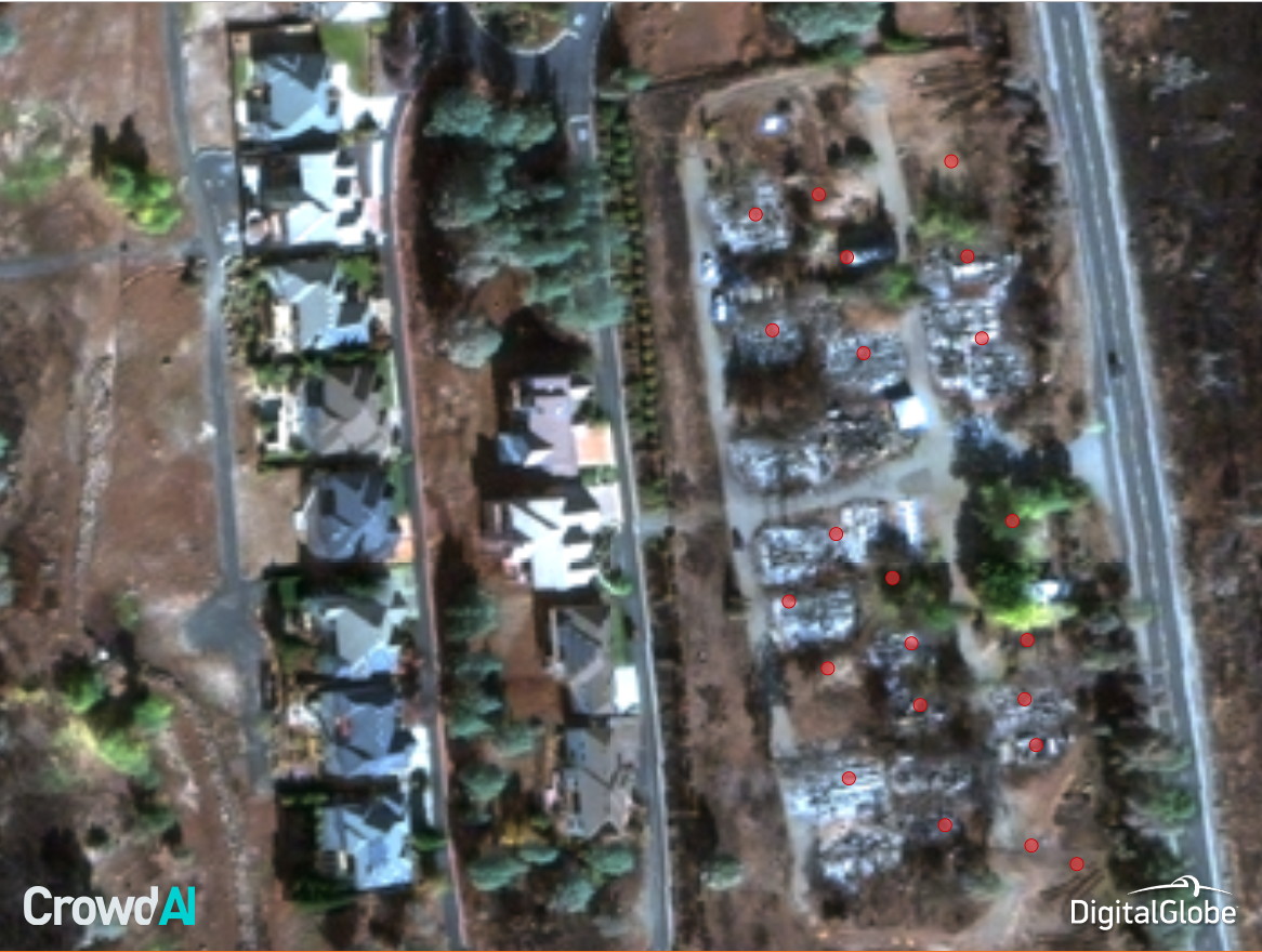
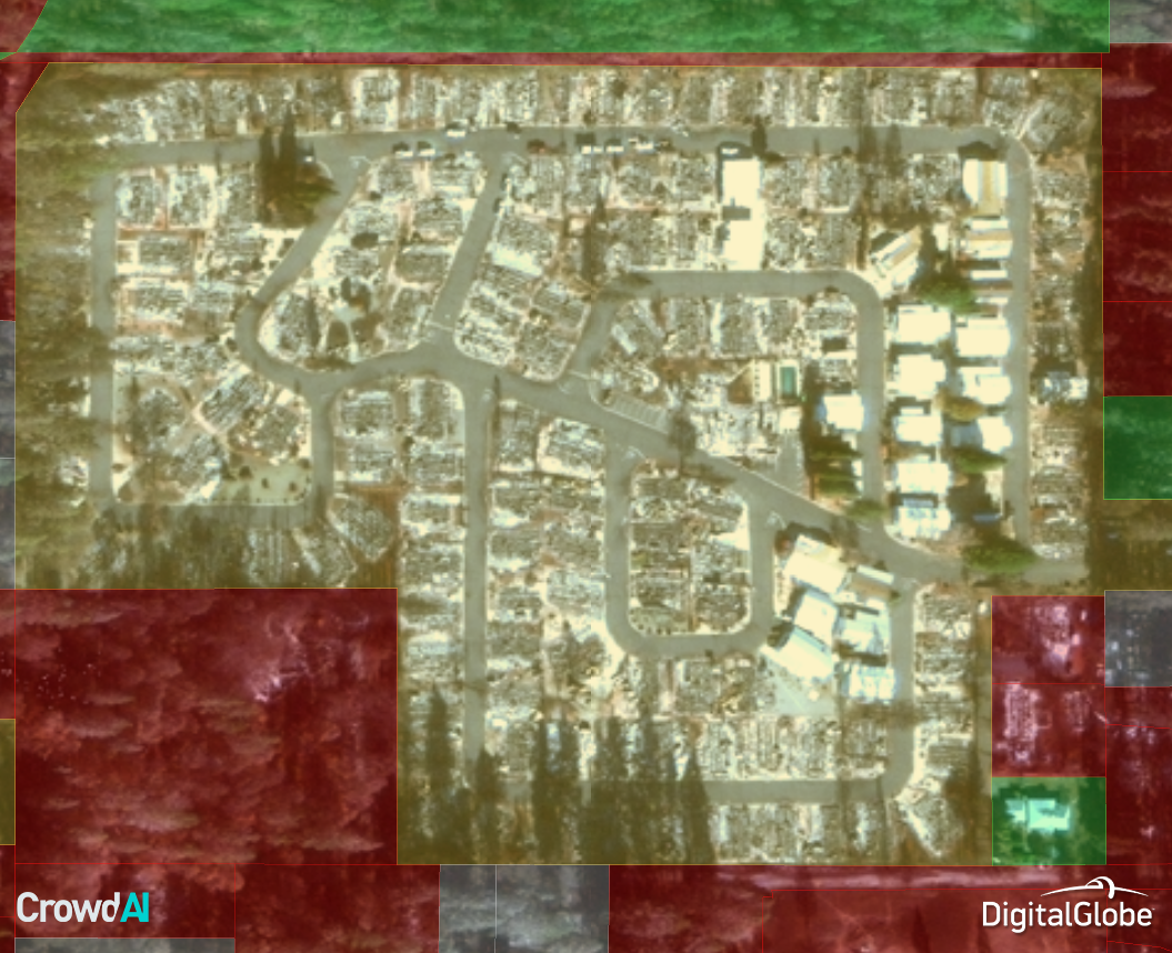
Using imagery from after the fire, we again detected structures, this time comparing those structures and their size to the before imagery. Subtracting out the structures that remained left us with centroids (red) of destroyed structures.
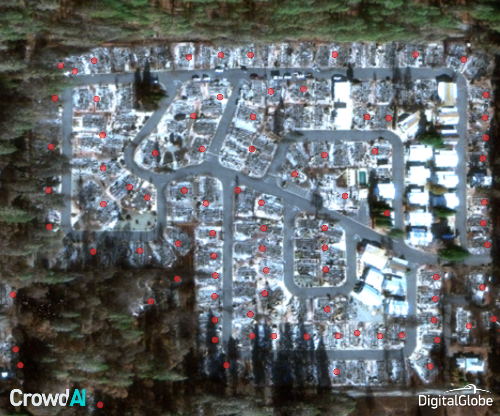
Looking across the entire region gave us the true extent of the devastation of the wildfire.
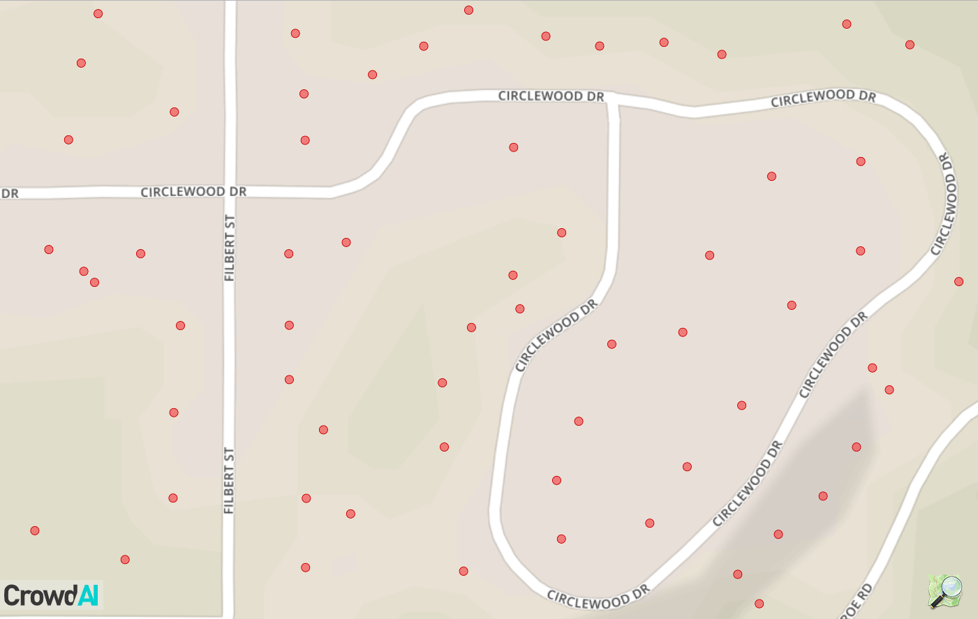
We took the locations of each damage building and layered them onto standard mapping tools, such as Google Earth or ArcGIS, that first responders and other officials are already using to coordinate relief efforts.
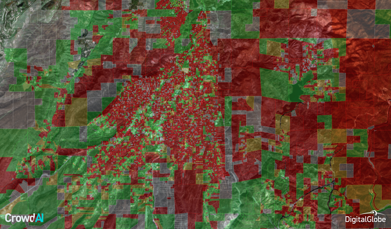
Once our models had identified all destroyed structures, we integrated the geolocations of those buildings with the existing parcel map of Butte County, and categorized each parcel based on the number of damaged structures, from low to high.
We can then scale this across the entire impacted region. (Note: grey parcels have no structures visible).
Correlating data like this can help residents, local officials, and insurance companies begin to understand the extent of damage immediately after disasters. We believe that our technology can be used to monitor disasters as they occur and help scale repair efforts. CrowdAI is committed to using our unique technology to aid in humanitarian and disaster relief efforts, both in the U.S. and abroad.
As always, a special thanks to DigitalGlobe for making high-resolution imagery available so quickly after disaster events.